Ölüdeniz Map: How the Blue Lagoon, Belcekız Beach and Ovacık Fit Together
A visitor's guide to the Ölüdeniz map: where the Blue Lagoon, Belcekız beach, Ovacık and Hisarönü sit, how far apart they are, and how to reach each.
On this page
Ölüdeniz is a small village and beach resort in the Fethiye district of Muğla Province, on the Turquoise Coast of south-west Turkey. The name covers both the bay and the settlement, so the first job on any map is to separate the village, the beach strip and the Blue Lagoon (Ölüdeniz, literally Dead Sea) from the villages that sit behind them. This guide lays out those parts in the order you will use them, from the lagoon out to Kayaköy, Çalış and the Lycian sites; the Things to Do in Ölüdeniz page fills in the days around them.
What the Ölüdeniz map actually shows
At the widest scale, Ölüdeniz is a village and beach resort in the Fethiye district of Muğla Province, on the Turquoise Coast of south-west Turkey, at the conjunction point of the Aegean and Mediterranean seas. The larger Fethiye area belongs on the same map: the Gulf of Fethiye is the water that both Ölüdeniz and Fethiye look out on.
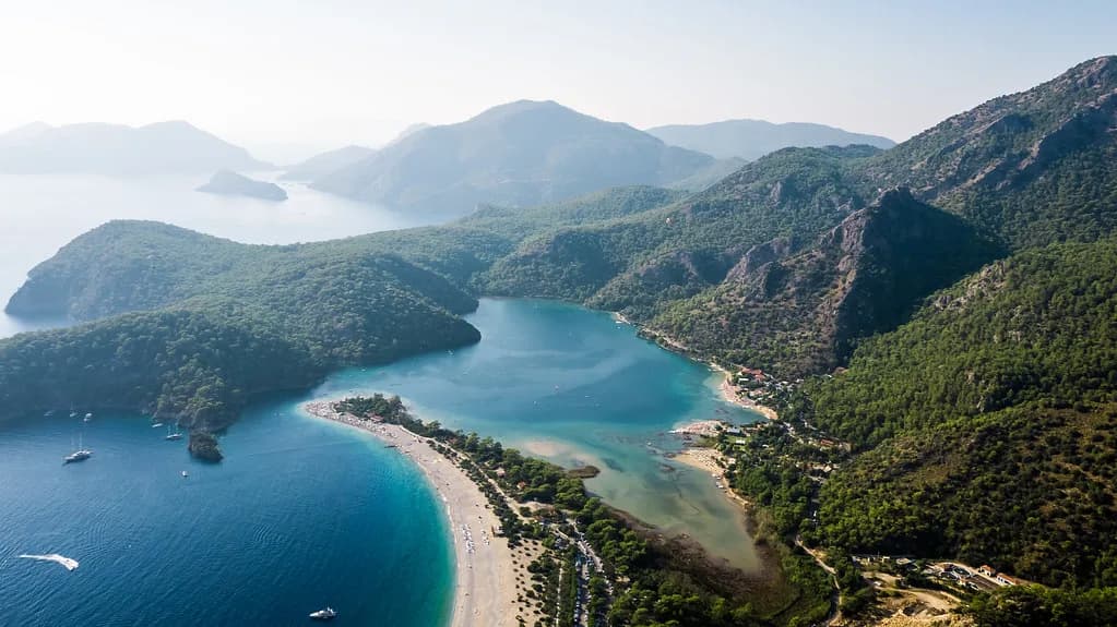
Ölüdeniz is most useful read as a small core with long arms. The beach, the village and the lagoon sit close together, while Ovacık, Hisarönü and Kayaköy sit behind the resort and Fethiye and Çalış sit further north. If you are planning the rest of the trip, the Things to Do in Ölüdeniz page fills in the days around these places; the map is the skeleton they hang on.
Coordinates for the resort are listed as 36° 34' 0.26" N and 29° 08' 40.81" E. Treat these as a pin for the settlement, not a walking instruction: the beach strip and the lagoon are separate points on a phone map, and the road between them curves round the bay.
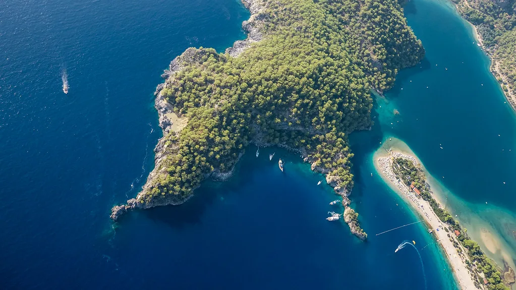
The two halves of the resort: village strip and Blue Lagoon
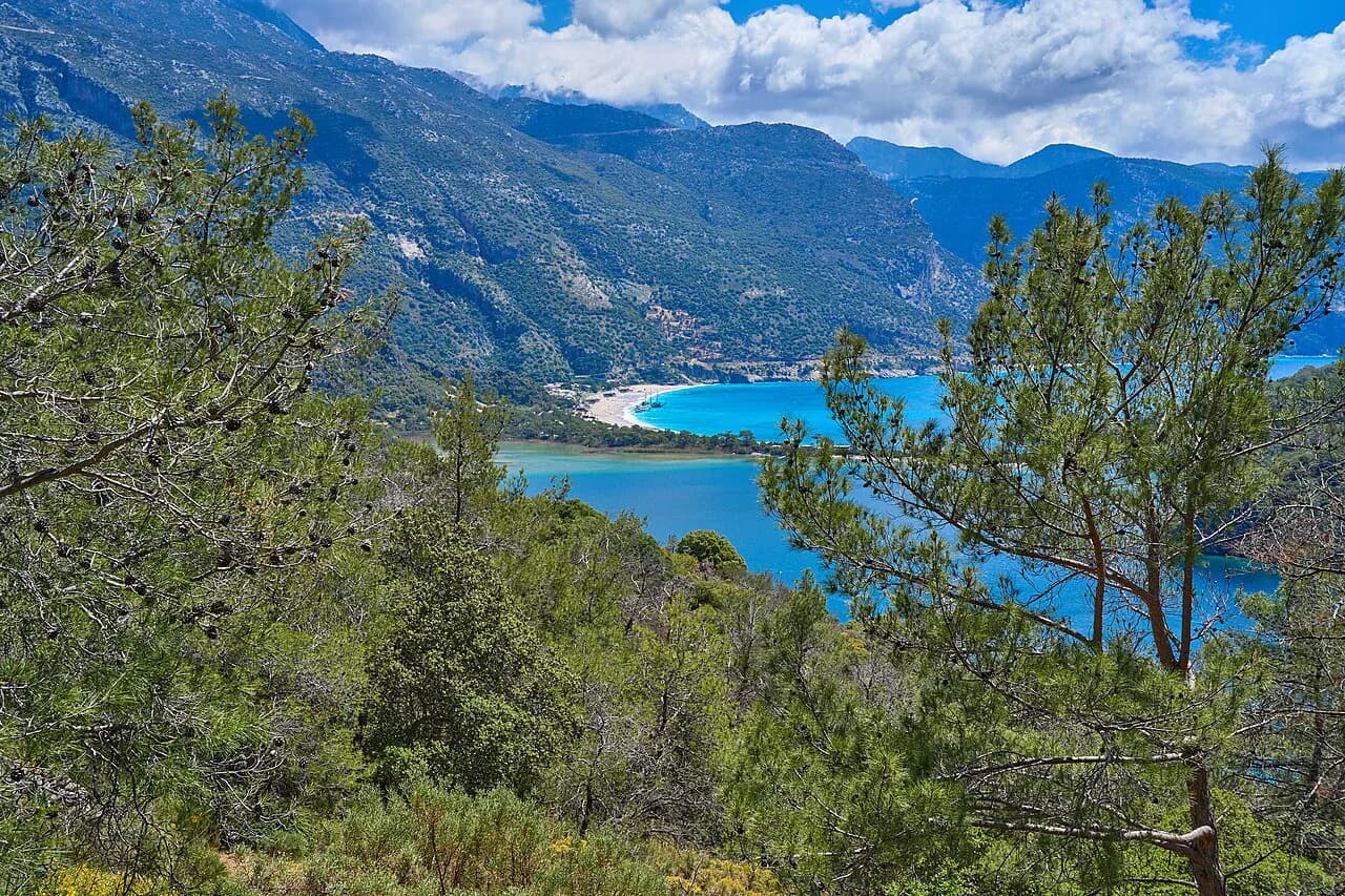
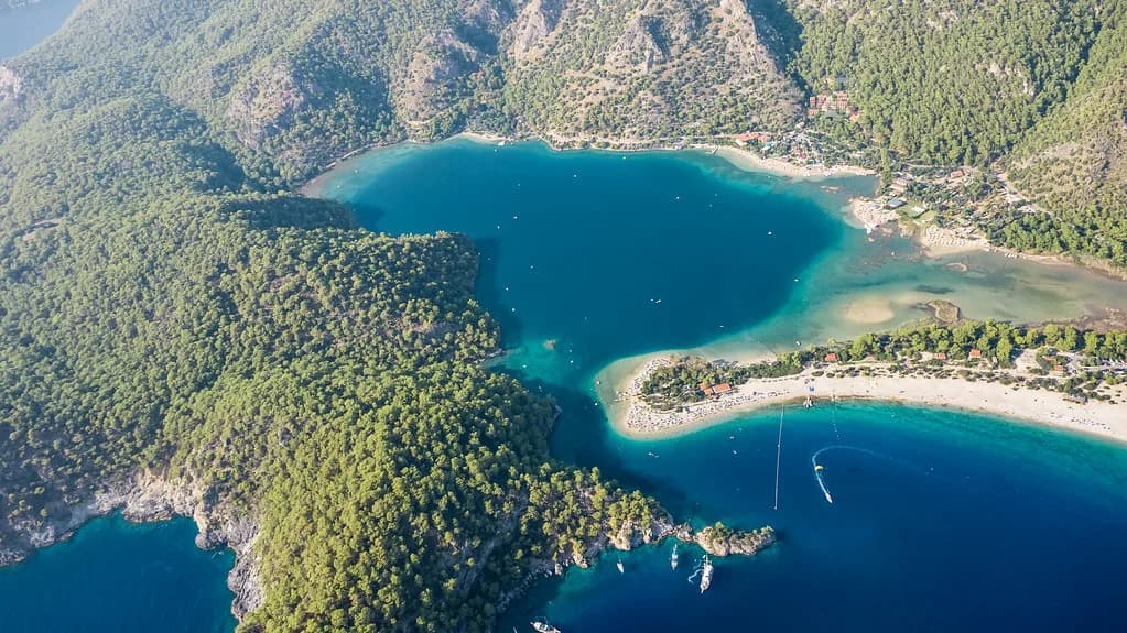
The name Ölüdeniz translates literally as Dead Sea, from water calm enough to stay still even in storms; the official English name visitors use is the Blue Lagoon. That calm is what makes the lagoon the obvious first pin when you open a map. Mark this point before you set off, since the lagoon and the main beach are not the same pin.
In practice, plan two pins: one for the village and beach strip where the shops, cafés and dolmuş drop-offs cluster, and one for the lagoon itself. On a phone map, zoom in until the road and the bay outline separate, then set both as saved places. That way a wrong turn on the strip does not send you walking to the lagoon by mistake.
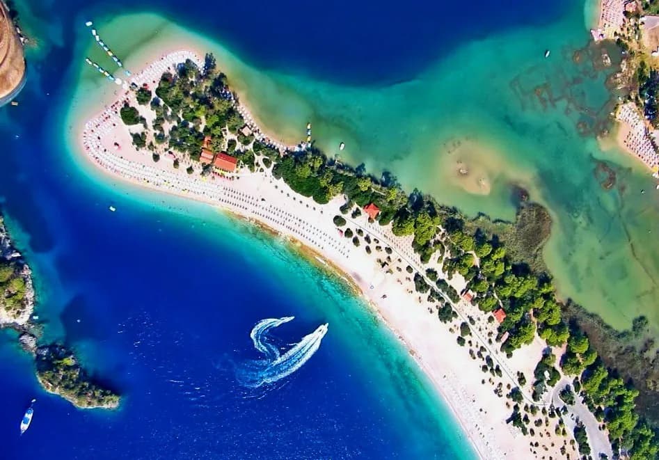
The beach side of the resort is the strip of sand and the road behind it. If a map does not clearly label the beach, search for the resort name and then zoom in on the shoreline, because a pin dropped on the village centre will put you inland rather than at the water. Orientation on the ground is then simple: the water on one side, the strip and the road behind it.
Ölüdeniz's neighbours: Ovacık, Hisarönü and Kayaköy
Ovacık sits 4 km from Ölüdeniz, at the foot of Babadağ, and is within easy walking distance of Hisarönü, on the local dolmuş route to Fethiye. Hisarönü itself lies between Ölüdeniz and Ovacık at 450 m above sea level, which is why it feels slightly cooler than the beach. On the map, this is a short chain climbing inland from the coast, with Babadağ rising behind it.
Kayaköy, the deserted village known as the Ghost Town, is 10 km from the beach and lies on the road out towards Gemiler from Hisarönü. It sits in an isolated valley, and the surviving old houses and churches are the reason to pin it. Allow a half-day rather than an hour: the distance is short, but the site rewards wandering.
If your map shows only one settlement inland, it is probably Hisarönü. Pin all three separately, then check the road that links them, and you have the whole inland cluster in view.
Fethiye and Çalış Beach to the north
Fethiye town holds the Lycian rock tombs cut into the cliff face above the streets, and its old quarter is a warren of shop-lined lanes rather than a grid. Put the rock tombs and the old quarter on the map as two pins; the tombs are visible from much of the town, so they double as a landmark when you are lost.
Çalış Beach is 5 km north of Fethiye, a 2 km stretch of coarse sand and pebbles facing Fethiye Bay and its small islands to the west. It is flat and breezy, reached by water taxi or minibus, with a pedestrian promenade of bars, cafés and restaurants behind the shore. Pin the promenade rather than the beach name, which can land you at either end of the 2 km.
For shopping, Fethiye's old quarter and the resorts' own strips are where most of it happens; the Shopping in Ölüdeniz page covers what is on offer without sending you across the bay for a look. If a market is on your list, check the market day locally before you build a morning around it.
How the dolmuş routes knit the map together
Ölüdeniz is served by the dolmuş route that also connects Ovacık and Hisarönü and runs on to Fethiye. Because Ovacık, Hisarönü and Ölüdeniz sit in a short chain, the same line passes through them in sequence. Frequencies, fares and the last service of the evening are not published here, so ask at the dolmuş stop or your accommodation on the day and plan the return before you set out.
For Çalış, the alternative to the minibus is the water taxi from Fethiye, which turns a road journey into a short crossing of the bay. Pin both the Fethiye water-taxi landing and the Çalış promenade to see how short the crossing is. Do not rely on either running late into the night without checking.
Walking works for the core: Ovacık to Hisarönü is described as easy walking distance, and the beach strip to the village is short. Save the dolmuş for the Fethiye run and the Kayaköy and Gemiler road.
Further out on the same map: Gemiler, Butterfly Valley, Saklıkent and Lycia
Gemiler Beach lies 7 km along a dirt road beyond Kayaköy, a small beach under pine and olive trees facing St Nicholas Island, which is reached by boat. Butterfly Valley is 5 km from Ölüdeniz, and Saklıkent Gorge is about 50 km away. These three sit at very different distances, so pin them individually and treat only Gemiler as a short hop.
The Lycian sites stretch further: Xanthos, Letoon, Pinara, Tlos and Myra are the antique cities the area is used as a base for, and excursions to them can be arranged locally. Patara's sands, 33 km long, and the Akdağ summer pastures are within easy day-travelling distance. By this point the map has become a day-trip planner, not a resort plan.
Patara and the Lycian sites lie well beyond the beach and village core. Ask locally which excursions are running during your stay, since timetables vary by season and demand.
Arriving: which airport goes on the map
Dalaman Airport is one of three international airports serving south-west Turkey, the others being Milas-Bodrum and Antalya. Dalaman has two terminals, with the old terminal used for domestic flights. If you are coming from the UK or Ireland on a package or scheduled flight, Dalaman is usually the practical pin for this stretch of coast; Milas-Bodrum and Antalya are the alternatives if the flights suit better.
The same listing names the Gulf of Fethiye, Göcek and Babadağ among the places of interest around Ölüdeniz, so all of them belong on the arrival map. Transfer times and airport transfer prices are not published here: book through your accommodation or a licensed operator and confirm the price in writing before you travel.
Using a phone map in Ölüdeniz: what to pin before you set out
Pin six things before you leave your accommodation: the Blue Lagoon, Belcekız beach, the village strip, the dolmuş stop, Kayaköy and the Fethiye water-taxi landing. With those saved, a wrong turn costs minutes rather than an afternoon. Download the area for offline use in case the signal drops on the coast road.
If you plan an evening out in the villages, pin your restaurant before you go; the best restaurants in Oludeniz page covers the kind of places to look for. If you would rather eat where you land, pin the Hisarönü junction and walk from there.
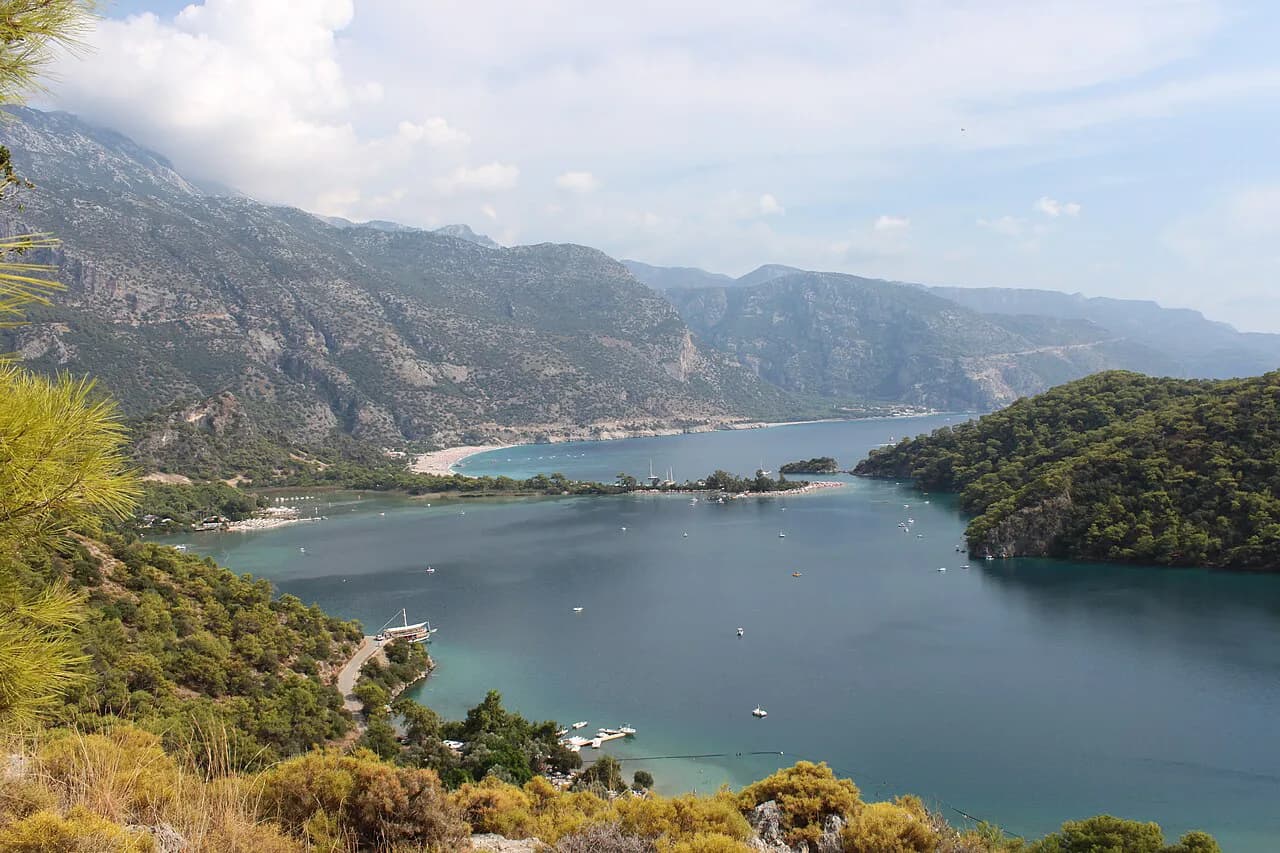
For orientation on the ground, use the sea: the bay is on one side, the mountain behind, and the lagoon at the head. Any map that shows the water outline is enough to work out which way you are facing. A printed or downloaded resort map is another useful cross-check when a sign is unclear.
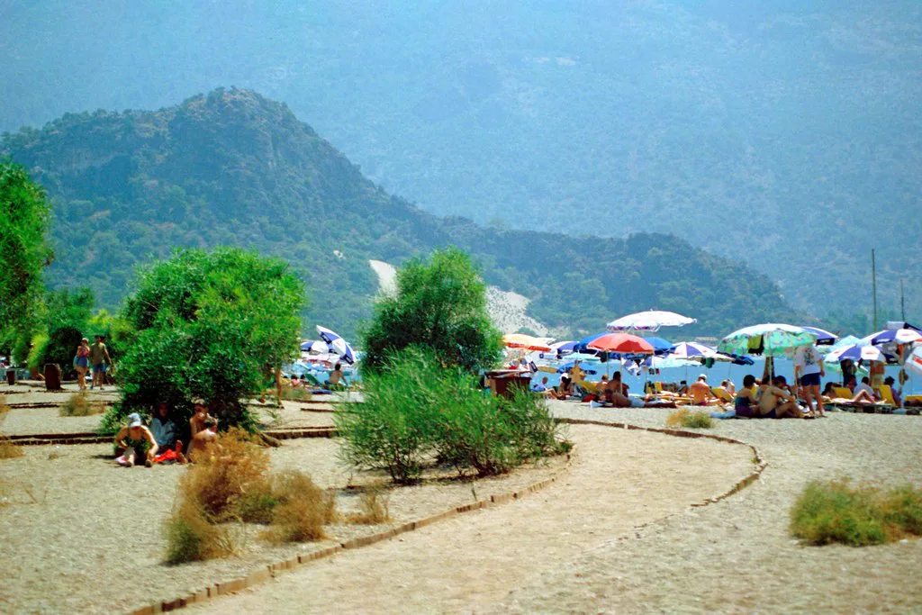
Which pins go on your Ölüdeniz map?
The resort is compact: village, beach and lagoon cluster together, Ovacık is 4 km inland, Hisarönü sits between them at 450 m, and Kayaköy is 10 km from the beach. Çalış Beach is 5 km north of Fethiye and reached by water taxi or minibus. That is a manageable core, with Gemiler, Butterfly Valley, Saklıkent and the Lycian sites stretching out beyond it.
Before you travel, check current dolmuş times, boat-taxi running and any excursion you plan to join with your accommodation or the Fethiye tourism office. Those details are not fixed in any guide, and a five-minute question at the start of the day saves a long walk at the end of it.
Explore more Oludeniz guides
Sources
Notes for your next Turkey trip
Optional updates when we add or correct a town guide.
You might also like
Continue reading
More guides you'll find useful