Dalyan Map Guide: Town, River and Delta Layout
A Dalyan map guide to the town centre, river front, boat landings and delta, with road distances to Dalaman airport, Marmaris, Fethiye and the ancient sites.
On this page
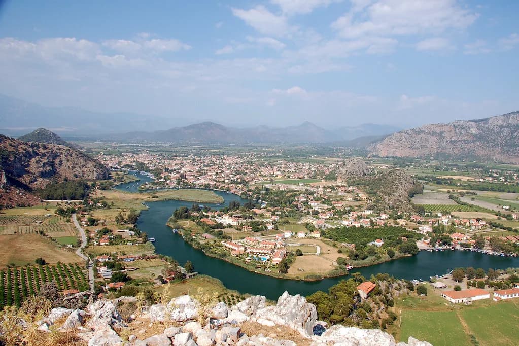
You need three maps to read Dalyan properly. One covers the small, low-rise town centre on the river, a second covers the water downstream through the delta and upstream to Lake Köyceğiz, and a third covers the roads out to Dalaman airport, Marmaris, Fethiye and the ancient sites. This guide lays all three out so you know what to walk, what to boat and what to plot on a road map.
The town sits on Turkey's south-west coast, where the Mediterranean meets the Aegean, with the river running through it and Lake Köyceğiz opening upstream behind it. Almost every sight visitors come for is on the water or reached from a jetty, so a town plan alone will not get you to the places you came for.
What the Dalyan map shows at a glance
Picture three layers stacked on one outline. The bottom layer is the river, running from Lake Köyceğiz in the north through the town and out through a reed-filled delta to the sea. The middle layer is the town, a compact grid of restaurants, shops and bars that locals walk in ten to fifteen minutes. The top layer is the road network reaching out to the coast resorts and inland sites.
Most confusion comes from mixing those layers. Iztuzu Beach, the mud baths and the Kaunos ruins are not town-centre stops on foot; they sit downriver or upriver and are reached by boat or minibus. Treat the jetties as the hub of your map and the streets as the easy walking ring around it.
Strict planning rules have kept every building to two storeys or less, so there are no high-rise hotels or tower blocks to sight your position by. Use the river bends, the tombs cut into the hillside opposite and the shape of the bay as your landmarks instead.
Where Dalyan sits in Turkey
Dalyan lies in Muğla province on Turkey's south-west coast, roughly midway between the resort hubs of Marmaris and Fethiye, in the Ortaca district rather than one of the larger resort towns. On an online map, searching for Dalyan, Ortaca gets you there faster than searching for the town alone.
Turkey's western edge borders Greece and Bulgaria, and its north-east borders Georgia and Armenia, while Dalyan sits on a south-west coast that unites the Aegean and the Mediterranean. That explains why the road map matters: you approach the town by road and then move about it by water.
The town itself: a walkable low-rise centre
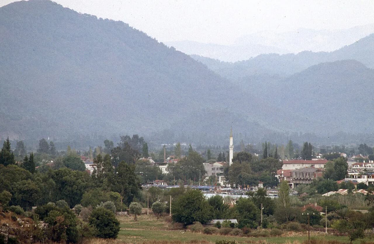
The centre is small enough to cross on foot in a quarter of an hour. Restaurants, shops and bars, plus a good selection of supermarkets, sit within ten to fifteen minutes' walking distance of each other, so the whole centre is your neighbourhood once you pick a base.
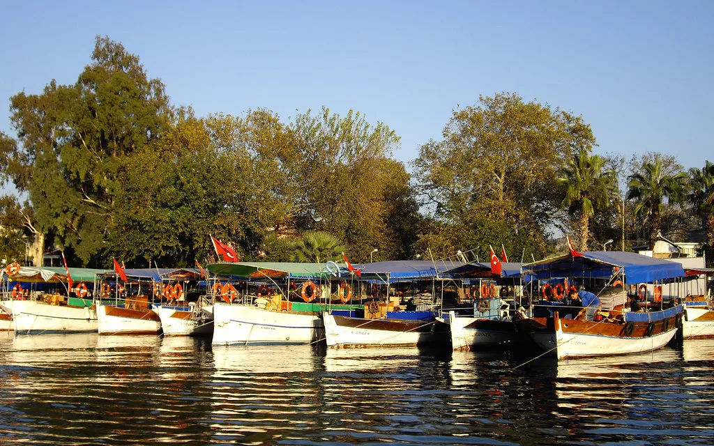
Bars, restaurants and cafés built along the river are single-storey and sit in step with the reeds and water. On a map, the riverside strip is one continuous line of terraces rather than a street you walk down between buildings; if you can see the water, you can find your way back to the centre.
For what fills the streets beyond the riverside terraces, from museums to the market, see the wider things to do in Dalyan before you plot a route. Some of the most worthwhile stops are a short walk from the centre rather than on the waterfront itself.
Orienting in the centre: river front and boat landings
The river front is the point from which everything else is measured. Boats leave from the landing area by the centre, heading either downstream towards the sea and Iztuzu or upstream to the lake. Walk the front once on arrival to see which jetties serve which direction.
To reach the Kaunos side, a small group of enterprising older women in the town centre offer river crossings by rowing boat for a modest fee. Treat that crossing as a short hop on the water map rather than a hike, and a cheap way to see the riverbank terraces from the water.
Downstream: the reed delta and Iztuzu Beach
Downstream of the town, the Dalyan River drains through a labyrinth of reeds into the sea. The channels twist enough that you lose your sense of direction, which is why boats follow a set line rather than cutting straight out, past kingfishers and fish swimming alongside in clear water.
Iztuzu Beach, also called Turtle Beach, sits at the far end of the delta where the river meets the sea, in a protected conservation area for the loggerhead turtle, Caretta caretta. Reach it by boat through the delta, or by dolmuş minibus from the town centre on a scenic road that passes a lake and mountains around the bay.
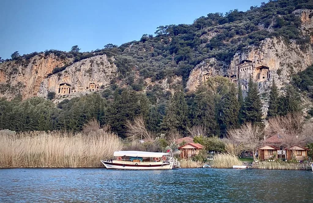
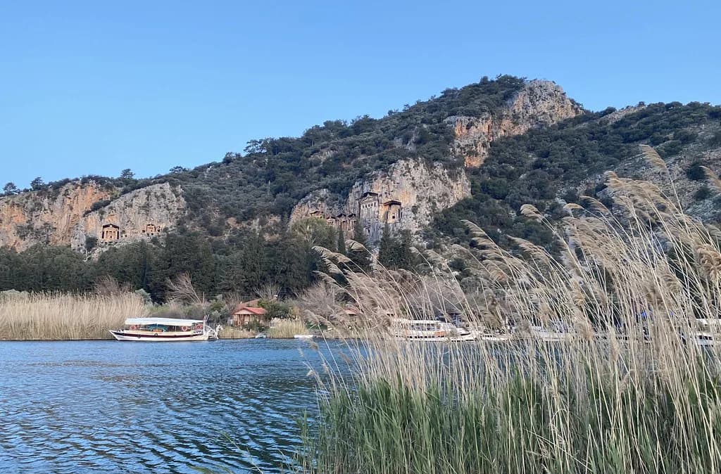
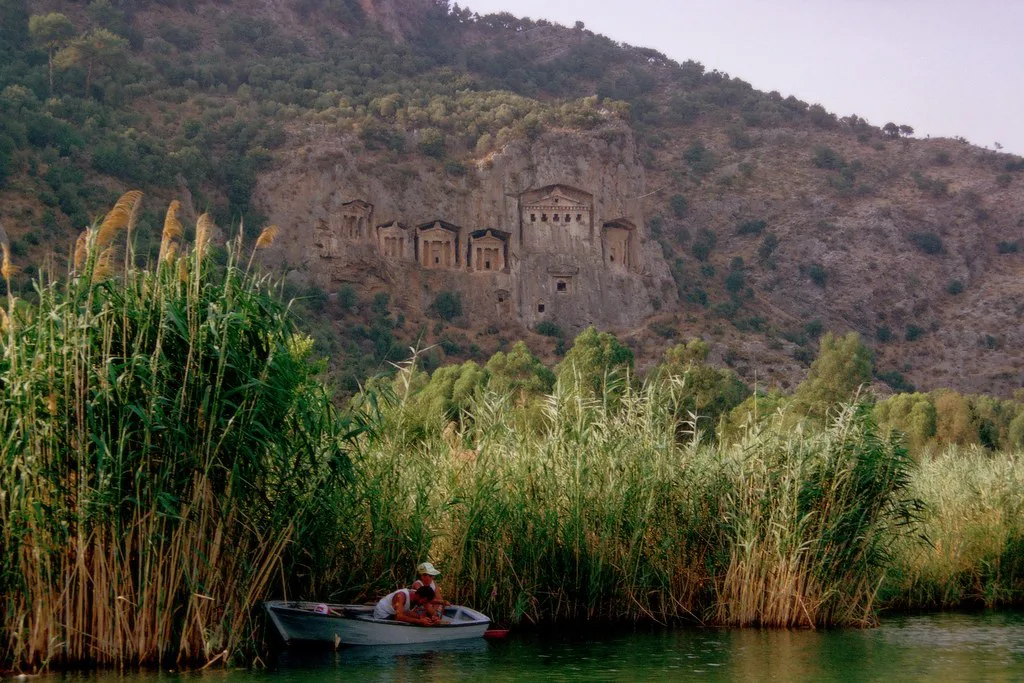
The rock tombs appear on the right as you head towards Iztuzu, standing above the riverbank on the Kaunos side. It used to be possible to walk through the tombs, but that was stopped some years ago because of the damage caused by visitors, and the ban remains, so plan to view them from the water or from across the river.
Upstream: Lake Köyceğiz, mud baths and hot springs
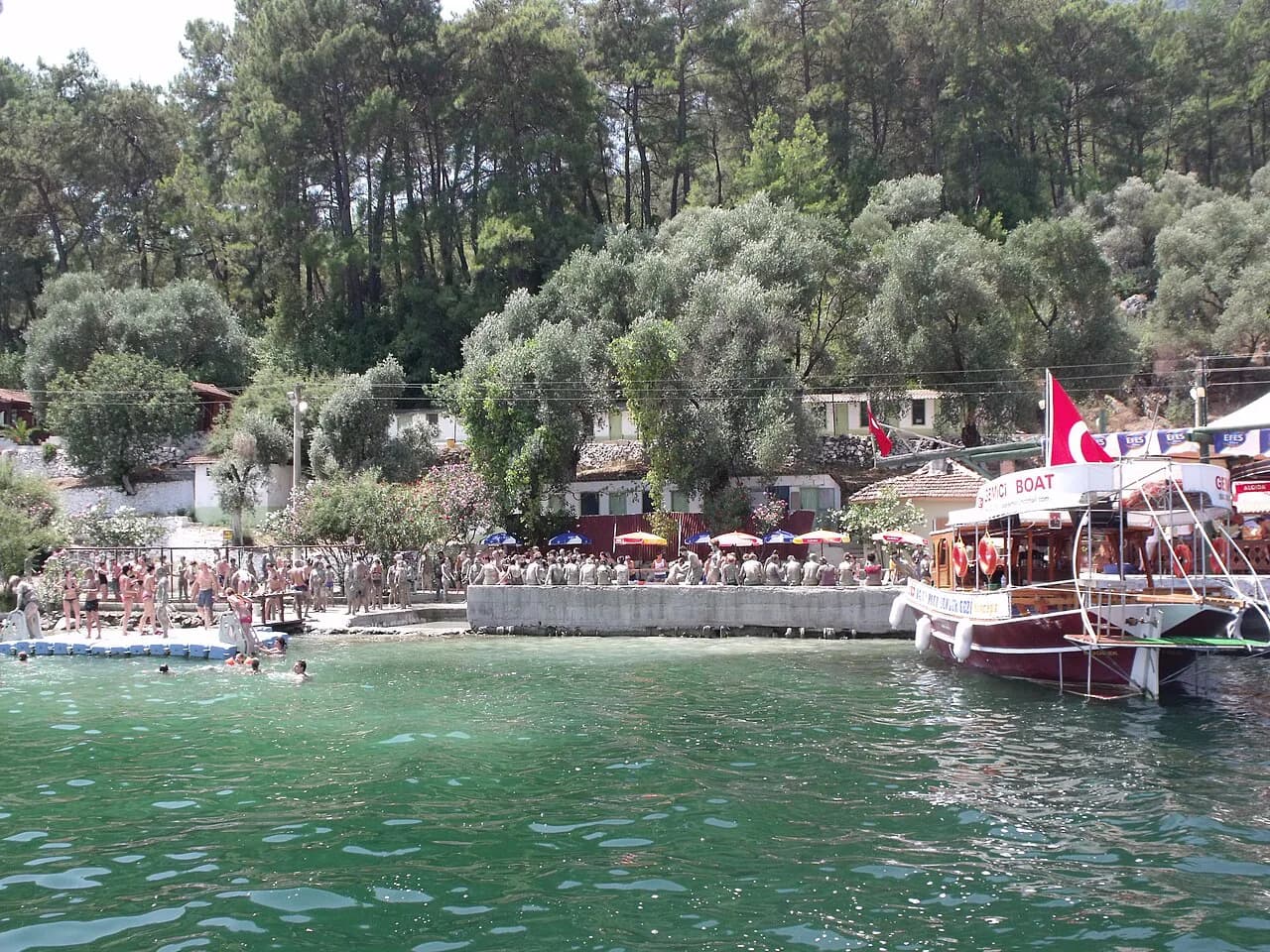
The same river leads north to Lake Köyceğiz, a freshwater lake that opens to the sea at Dalyan. On the upstream map the stops stack in order: first the Sultaniye mud baths and hot springs, then the lake itself, where boats anchor mid-water for a swim in fresh water; on a daily tour the lake is typically the second stop after the mud baths.
Downstream in the delta you will also see dalyans, the fish farms marked along the channels. They are working features rather than sights, but finding them on the water map helps you read which channel you are in. Leave a half-day for the upstream run and tell your boatman whether the lake or the mud baths comes first.
The rock tombs and Kaunos on the map
The Lycian rock tombs are carved into the mountainside above the river and are Dalyan's most recognisable feature. They sit on the Kaunos side of the river, which is why every downstream boat passes them on the right. Mark them on a map as a viewing point rather than a destination you climb to, since walking through the tombs has been prohibited for several years.
Kaunos itself is the ancient city at the foot of the tombs, with city walls and an amphitheatre whose walls appear on the right-hand side as you head towards Iztuzu. Combine the tombs and Kaunos on one outing, since they share the same bank and the same river crossing.
Getting to Dalyan: Dalaman airport and the roads in
Dalaman Airport is the nearest arrival point, 28 km from Dalyan and about 20 to 25 minutes by road, and arranging a transfer from your accommodation in advance is the simplest first-time option. Plot the airport on your road map before you land so you know which side of the bay you will be driving around.
Driving from the big cities is a longer haul: Dalyan sits 870 km from İstanbul, 710 km from Ankara, 320 km from İzmir and 270 km from Antalya. From the coast resorts the numbers are much smaller, with Fethiye 67 km away, Marmaris 90 km, Kalkan 126 km and Kaş 160 km. Treat the larger figures as a sign of how far you are travelling, and the smaller ones as hops you can make in a day.
Road distances worth plotting
The most useful short-trip distances cluster within an hour's drive. Ortaca is 12 km, Iztuzu Beach 12 km, Köyceğiz 20 km and Sarıgerme 31 km, with Dalaman Airport 28 km away.
For a food plan, the best restaurants in Dalyan sit within the walkable centre, so you can leave the car wherever you are staying. That is a relief after a long drive from the airport or from Fethiye, when the last thing you want is another short trip to dinner.
Ancient sites within reach on the same map
Dalyan works as a base for a wider circle of ancient sites. Ephesus is 210 km away and Pamukkale 213 km, both long day trips rather than casual outings. Closer in, Letoon is 130 km away and Patara 140 km, Tlos 105 km, Xanthos 200 km and Kekova 127 km; plot them as days out, not stops on the way into town.
Getting around without a car
If you are not driving, the local pattern is dolmuş minibus, river boat and taxi. The dolmuş from the town centre to Iztuzu Beach runs a scenic route past the lake and around the bay, and river boats cover the delta and the lake from the town jetties. Beyond those, you will need a tour or a taxi for the ancient sites, which sit outside the walkable area.
Confirm the day's timings at the jetty or with your accommodation before you set out, since boat departure times and fares change with the season. That matters most for the lake and mud bath trips.
Laying the map out for a two- or three-day stay
Give the town its own slow half-day first: walk the river front, note the jetties and find the market, whose layout is easier once you know the town grid. The Dalyan market is the anchor for that morning, with the river terraces and cafés a short walk away.
Day two belongs to the water. Take the downstream boat for the delta, the tombs and Iztuzu, or the upstream run for the mud baths and Lake Köyceğiz; do not try both in one day, because the channels make each direction a full outing. With a third day, keep it for one ancient site within range.
Which map do you actually need?
If you only have a phone, save the town centre and the river jetties first, then screenshot the road distances from Dalaman airport and Fethiye. The water map can be worked out at the landing, where the boatmen will point you to the right jetty for the delta or the lake.
What will not help is a single town plan treated as the whole picture. Dalyan's best sights sit on the river, and the river is the map.
Frequently Asked Questions
Which part of Turkey is Dalyan in?
Dalyan lies on Turkey's south-west coast in Muğla province, on a coast where the Mediterranean meets the Aegean, roughly midway between Marmaris and Fethiye. On a map, look in the Ortaca district rather than the larger resort towns.
Can you walk to the Dalyan rock tombs?
No. Walking through the tombs has been prohibited for several years because of damage caused by visitors, and they are viewed from the river or from across the water rather than from a path through them.
How do you get to Iztuzu Beach from Dalyan?
Take a boat downstream through the delta, or the dolmuş minibus from the town centre, which runs a scenic route past a lake and around the bay. The beach is at the far end of the delta where the river meets the sea.
How far is Dalyan from Dalaman Airport?
Dalaman Airport is 28 km from Dalyan, about 20 to 25 minutes by road. From Fethiye the drive is 67 km, and from Marmaris 90 km.
Sources
Notes for your next Turkey trip
Optional updates when we add or correct a town guide.
You might also like
Continue reading
More guides you'll find useful