Gallipoli: A Practical Guide to the Peninsula and Its Sites
Plan a visit to the Gallipoli peninsula: how to reach it from Çanakkale and Eceabat, which memorials and cemeteries to see, and how the sites are spread out.
On this page
Gallipoli is the peninsula on the European shore of the Dardanelles where Australian and New Zealand Army Corps troops landed at dawn on 25 April 1915, and the entire battleground with its cemeteries is preserved as the Gallipoli Campaign Historic Site. The sites are spread over a peninsula roughly 30km north to south and 25km west to east, so where you base yourself in Çanakkale or Eceabat decides how much of it you see.
This guide separates the Anzac-held ground around Anzac Cove and North Beach from the British and French sector at Cape Helles, names the ridges and posts visitors come for, and sets out the trade-off between a guided coach tour and reaching the memorials under your own steam.
What Gallipoli is and where the peninsula sits
The peninsula lies on the western, European side of Turkey, in the region known as Thrace, with the Dardanelles strait separating it from the Asian shore. Çanakkale sits on that Asian shore, and the Narrows run between Çanakkale and Eceabat on the peninsula side, which puts both towns at the centre of any transport decision.
The ground visitors cover runs from Suvla Bay in the north to Cape Helles at the southern tip, with the Sari Bair range forming a semi-circle from northern Suvla Bay down to Kabatepe in the south. The peaks along that range stand between 200 and 300 metres high, which is why the inland posts feel so elevated compared with the beaches.
The landscape matters to how you plan a day: the Aegean coast is dramatic, and the farmland behind it has been left largely untouched since the First World War. That combination of steep ridges, narrow beaches and open fields is exactly why the sites are strung out over long distances rather than gathered in one place.
How to get there from Çanakkale and the Dardanelles
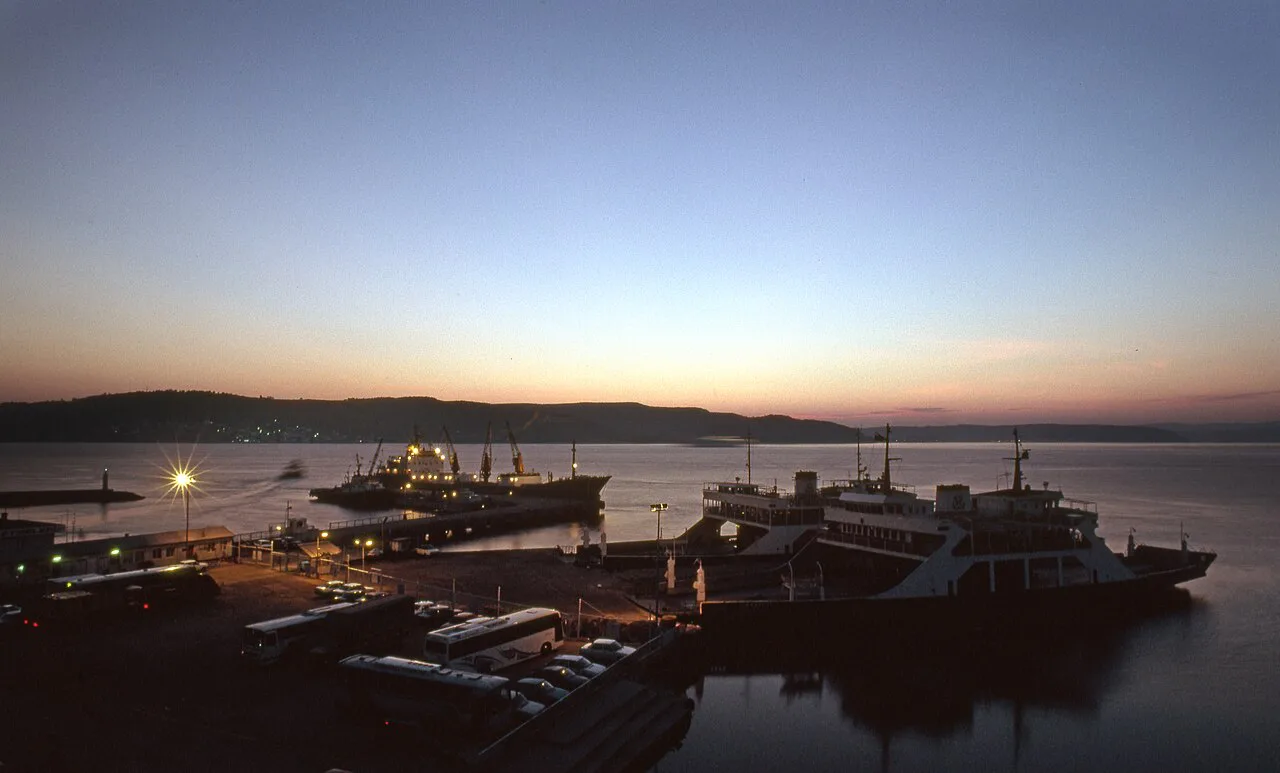
Most visitors approach the peninsula from Çanakkale on the Asian shore, or from Eceabat on the peninsula side of the Dardanelles. Treat the two towns as your decision point: Çanakkale gives you town facilities and the strait crossing, while Eceabat puts you on the peninsula itself, closer to the southern landing beaches.
The three Allied landings from the Aegean Sea were made on the western shores of the peninsula, with British forces at Helles at the southern tip and French troops mounting a feint at Kum Kale on the opposite shore before moving to Helles. Knowing that geography helps you read a map of the campaign and work out which sector a given memorial belongs to before you set off.
Ferry timetables, crossing fares and the current state of road access change with the season, so confirm the crossing and your onward route locally before committing to a day on the peninsula. A guided tour removes that planning burden entirely, while independent travel gives you the freedom to linger at Lone Pine or walk down to the beach at Anzac Cove.
The Gallipoli Campaign Historic Site and what is preserved
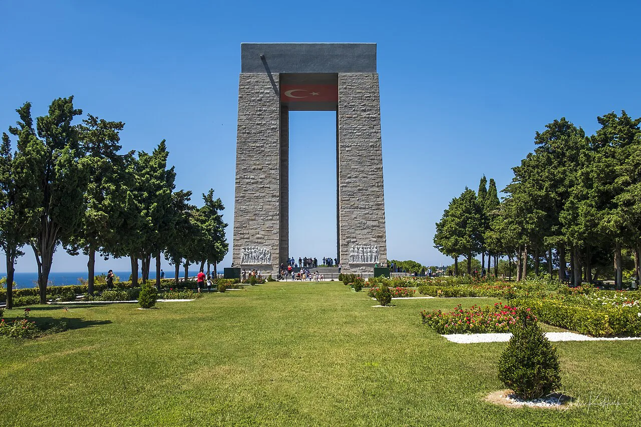
The entire battleground, together with its cemeteries, is preserved as the Gallipoli Campaign Historic Site, and several sections hold memorials and monuments to individual battles. That status is what keeps the trenches, cemeteries and monuments legible as a single landscape rather than a scatter of separate attractions.
Visitors from Australia and New Zealand make the journey each year to remember their soldiers, and the contribution of the original Anzacs is commemorated annually on 25 April. If you are travelling around that date, expect the peninsula to be busier, so check how commemorative arrangements affect access before you book anything.
For a closer look at how the fighting shaped individual corners of the site, our guide to the Gallipoli battlefields walks through the ground itself.
The Anzac area: Anzac Cove, North Beach and Ari Burnu
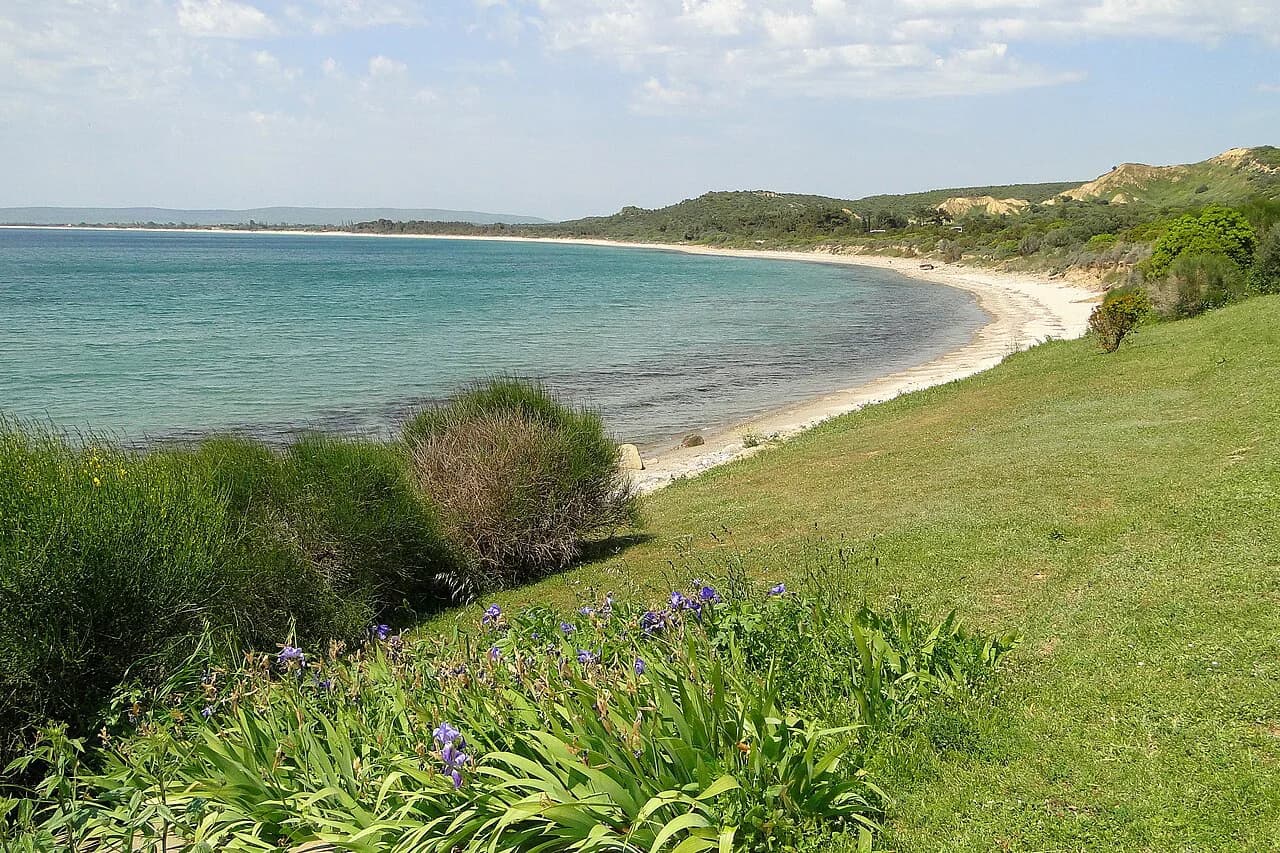
Anzac Cove is where the Australian and New Zealand troops came ashore on 25 April 1915, landing at dawn against steep cliffs held by Turkish soldiers defending their homeland. The cove and neighbouring North Beach were the two landing points that gave the Allies most of the ground they held from April to December 1915, a stretch later labelled Old Anzac.
A narrow beach runs below the cove, with the Aegean behind it, and a heartfelt scripture at its entrance pays tribute to the foreign soldiers and their communities. Ari Burnu, Hell Spit and Brighton Beach sit along the same coastal strip, so you can cover the shoreline memorials on a single stop, and our separate page on Anzac Cove goes into the cove itself in more detail.
Inland from the beach the ground rises immediately: Plugge's Plateau, Shell Green and Walker's Ridge sit between the coast and the posts, with Shrapnel Valley running behind the shoreline. Walking any of these short stretches shows you how little cover the landing force had, which is the single most useful thing to understand before you look at a campaign map.
The ridges and posts inland: Lone Pine, Quinn's Post, The Nek and Chunuk Bair
The Sari Bair ridge runs from Lone Pine in the south through Steele's Post, Courtney's Post, Quinn's Post, The Nek and Baby 700 to the north, and these names became familiar to Australian and New Zealand families reading daily accounts of the fighting. The distances between them are short on the ground but the ground is steep, so allow more time than the map suggests.
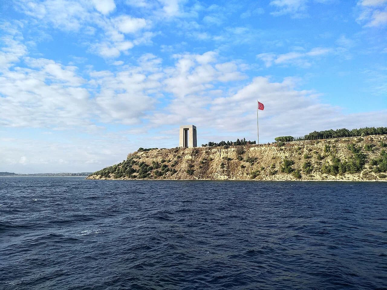
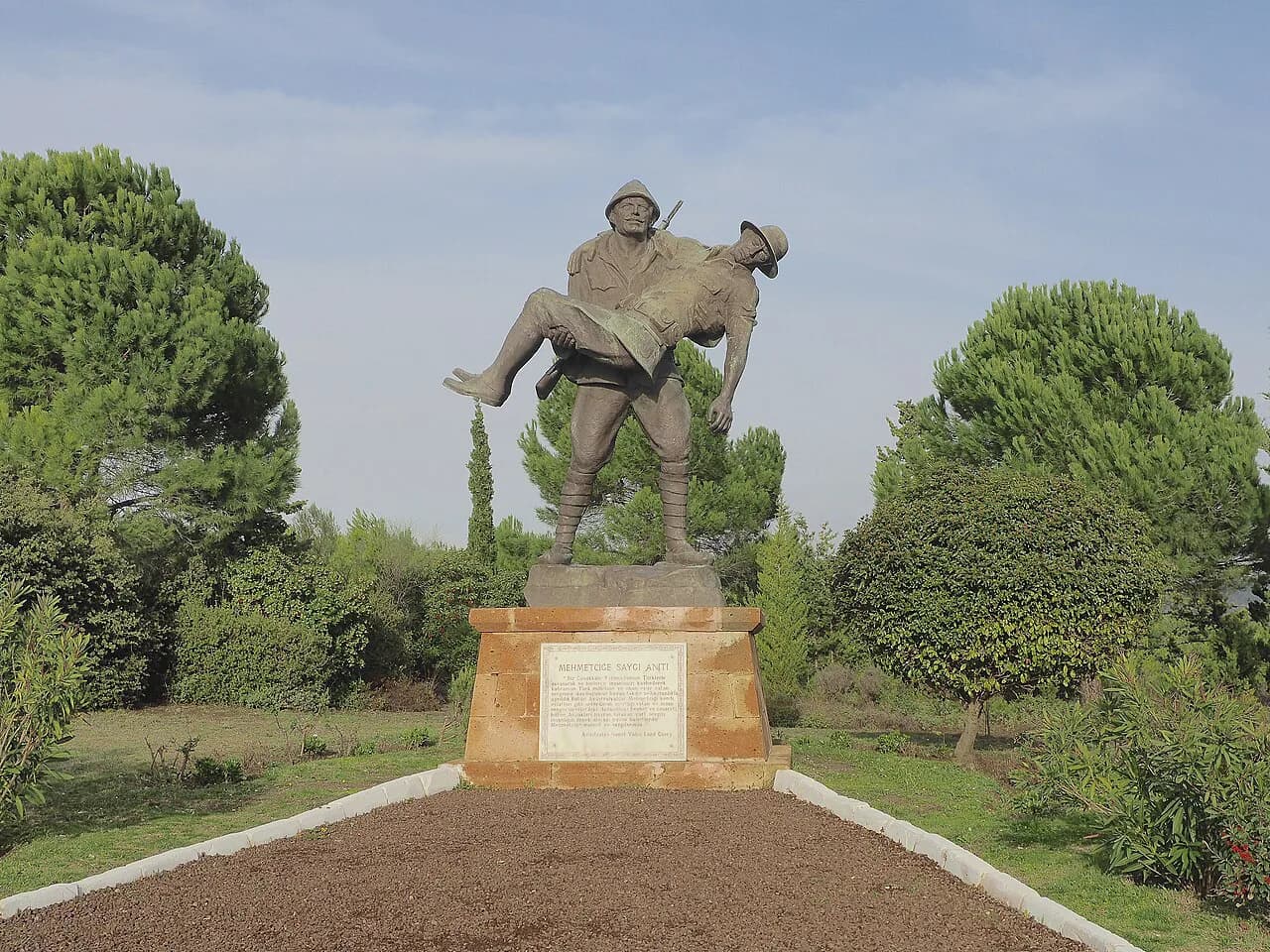
Chunuk Bair is the most iconic of the memorial sites, marked by a colossal statue of Atatürk, and Lone Pine lies about 3km away. Lone Pine is an Anzac cemetery named after the solitary pine that survived a forest fire, and its tombstones carry poetic epitaphs, including the grave of a 14-year-old soldier described as the youngest to die in the battles.
Further north, Hill 971, Rhododendron Ridge and Battleship Hill complete the ridge line, while Hill 60 sits between the Anzac and British-held areas behind the Ottoman line. Suvla Bay, immediately north of Old Anzac, was the scene of a further landing on 6 August 1915, and the ground there was held from August to December of that year.
Cape Helles and the British and French landings
Cape Helles, at the southern tip of the peninsula, was the British landing sector, with Krithia in the centre of the peninsula and Achi Baba the hill above it. Helles was not evacuated until January 1916, so it stayed in Allied hands longer than the Anzac sector.
On the same day as the Anzac landing, British forces came ashore at Helles and French troops launched a feint at Kum Kale on the opposite shore before moving to Helles soon afterwards. If you are working from Çanakkale, the Helles sector is the far end of the peninsula and needs to be planned as a separate leg rather than tacked onto an Anzac Cove morning.
The ground held and the shape of the campaign in 1915
From the Battle of the Landing in April 1915 until August, the Allies held only a slim foothold on the peninsula. After the August Offensive their forces gained some ground north of Anzac Cove and occupied Turkish trenches at Lone Pine in the south, which is why the map shows an Old Anzac area ringed by a larger zone held later in the year.
Landing at dawn, the Anzacs faced steep cliffs and Turkish soldiers determined to defend their homeland. The fighting dragged on for eight months with neither side able to make significant gains, and the Allied troops were finally evacuated when their objectives could not be achieved.
How long the peninsula needs and how to move between sites
Give the peninsula a full day at minimum and two if you want both the Anzac sector and Cape Helles. The sites run roughly 30km from Svula Bay to Cape Helles, and the inland posts sit on ridges above the coast, so a day spent hopping between them involves real driving plus short, steep walks.
Group your stops by sector: the Anzac cove shoreline, the ridge posts, then Suvla in the north or Helles in the south. Because most of the ground held from April to December 1915 was taken on or shortly after 25 April, the memorials cluster around the landing beaches and the ridges immediately behind them, which keeps the first half of your day compact.
Opening times and any site arrangements for the historic area are best confirmed at the time you travel, since they are not fixed for the season here.
Coach tours versus going under your own steam
A guided coach tour strings Anzac Cove, Lone Pine, Chunuk Bair and the intermediate posts into a single loop, which suits anyone without a car or with only one day. The trade-off is pace: you see more sites but spend less time at each, and Chunuk Bair and Lone Pine in particular reward a slower look.
Independent travel means arranging your own vehicle or driver from Çanakkale or Eceabat, then working out the route between the coastal memorials and the ridge posts yourself. It gives you control over timing at the cemeteries and viewpoints, but you carry the navigation and the driving on roads that climb between the beaches and the ridges.
Nearby: Çanakkale, Eceabat and the Asian shore
Çanakkale on the Asian shore and Eceabat on the peninsula both sit on the Dardanelles, and the Narrows between them are marked on campaign maps of the strait. Base yourself in one and the other becomes a crossing rather than a destination, so pick according to whether you want town facilities or immediate access to the peninsula.
The area is also within reach of Troy and the island of Bozcaada, both worth a separate day rather than an afternoon squeezed onto a Gallipoli itinerary. For how Troy fits among the country's other ruins, see our guide to ancient sites in Turkey.
Mosque and memorial etiquette on the peninsula
The cemeteries and memorials are commemorative ground, so treat headstones, epitaphs and grave markers as you would in any war cemetery: quiet voices, no climbing on monuments and nothing left behind. At Lone Pine the tombstones carry poetic epitaphs and the grave of a 14-year-old soldier, so allow space for other visitors who have come specifically to find a name.
If you stop at a mosque in Çanakkale or Eceabat, remove shoes before entering the prayer hall, keep shoulders and knees covered, and avoid walking in front of anyone praying. On the peninsula itself, remember that this is Turkish soil with Turkish memorials alongside the Allied ones, including the Atatürk statue at Chunuk Bair.
One day or two on the peninsula?
Take one day if you are based in Çanakkale and want the Anzac cove shoreline and the ridge posts, ideally on a guided loop that handles the driving. Take two if you want Cape Helles, Suvla Bay and time to walk between Lone Pine, Quinn's Post and Chunuk Bair without watching the clock.
Whichever you choose, read the campaign map before you go so the names on the memorials match the ground in front of you, and confirm crossings and site arrangements locally as your dates approach.
Explore more Canakkale guides
Sources
Notes for your next Turkey trip
Optional updates when we add or correct a town guide.
You might also like
Continue reading
More guides you'll find useful