Mount Nemrut: Visiting the Summit, Statues and Getting There
Plan a visit to Mount Nemrut in south-east Turkey: the summit tomb, the colossal statues, the East and West terraces, the climb, and getting there via Kahta.
On this page
Mount Nemrut is the hierothesion of King Antiochus I of Commagene: a temple-tomb and house of the gods crowning one of the highest peaks of the eastern Taurus in south-east Turkey. A visit means a pre-dawn or late-afternoon drive via Kahta, a climb of roughly twenty to thirty minutes, and an hour or so on a summit where colossal statues sit toppled around an artificial mound.
This guide covers what stands at the top, how the East and West terraces differ, the two ways up from the car park, the drive from Adıyaman or Gaziantep, and the sights that fit into the same day. I have left out ticket prices and opening hours because the summit is a remote archaeological site with nothing to buy at the top; the provincial culture and tourism office is the place to confirm arrangements before you commit to a pre-dawn start.
What Mount Nemrut is
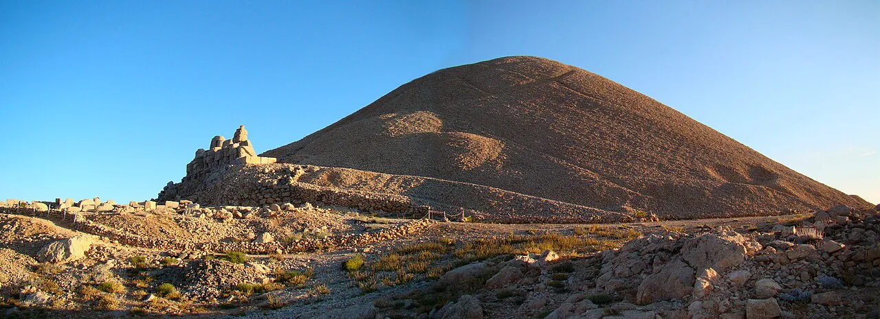
The monument was built by Antiochus I Theos, ruler of the small Kingdom of Commagene, which sat between the upper Euphrates and the Anti-Taurus Mountains as a buffer between the Seleucid Empire and Parthia. He ordered an artificial mound of crushed rock 50 metres high on the mountain's peak, with statues of himself among the gods placed at its foot. UNESCO lists the site as the hierotheseion, or temple-tomb and house of the gods, of Antiochus I.
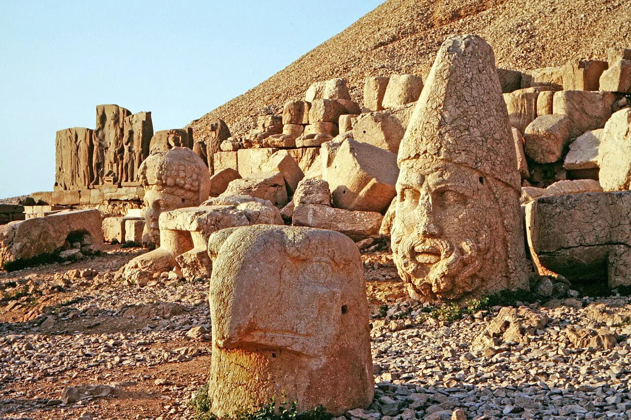
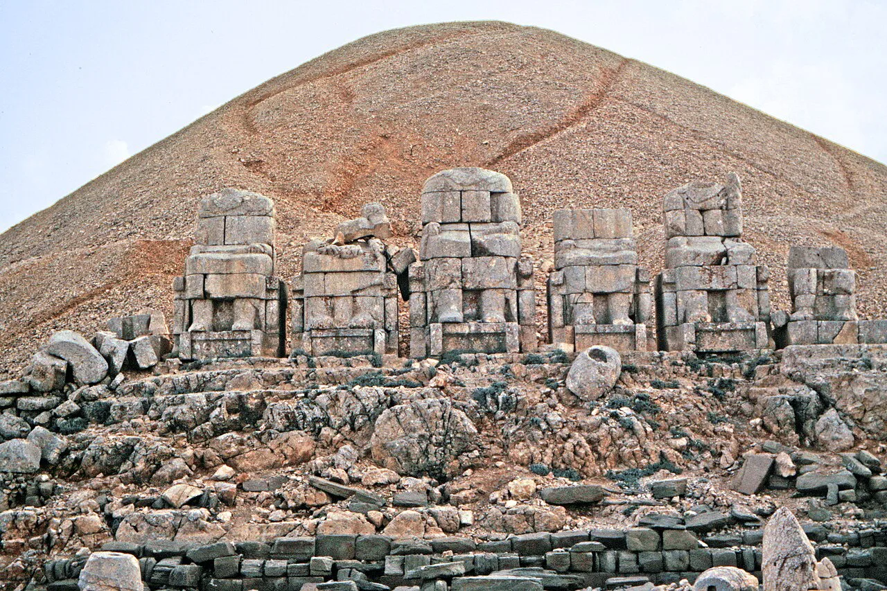
The mountain itself stands about 2,150 metres high, on the eastern edge of the Taurus range. The statues are 8 to 9 metres tall, and the heads now rest upright at the base of their old thrones after earthquakes brought the bodies down.
What the rubble mound still conceals has never been established with certainty, so treat the summit as an active archaeological puzzle rather than a finished monument. A Greek inscription found by early researchers sets out Antiochus's purpose in building it, and the site's sculptures are the clearest illustration of the blended Greek, Persian and Armenian state cult he tried to establish.
Where Mount Nemrut is
The site lies in the Kahta district of Adıyaman province, in Turkey's south-east, several dozen kilometres from the town at the foot of the mountain. Karadut is the closest village to the summit, and the access road runs off the Nemrut Dağı Yolu above it.
The nearest big cities for flights and long-distance buses are Adıyaman and Gaziantep, both of which put you within a drive of Kahta and then the summit road. Şanlıurfa, further south, works as a second base if you are combining the mountain with the plain around Göbekli Tepe. Plan the mountain as a half-day trip from Kahta rather than a stop you fold into a coastal itinerary.
The statues and terraces at the top
The summit divides into an East Terrace and a West Terrace, each lined with rows of seated figures: Antiochus with a pantheon that fuses Greek, Armenian and Persian deities, plus eagles and lions. The bodies have toppled but the heads remain largely intact, resting near their thrones and looking out over the Taurus.
One relief carries the famous lion horoscope, a detail that still draws astronomy-minded visitors trying to decode it. Walk both terraces before you leave; they face opposite directions, so the light and shelter differ sharply even though the distance between them is short.
Sunrise on the East Terrace or sunset on the West Terrace
Sunrise on the East Terrace is the standard visit: you climb in the dark and watch the first light pick out the heads. Sunset on the West Terrace is warmer but windier, and it suits anyone who would rather not start from Kahta at four in the morning. Allow about an hour and a half at the top if you want both terraces without rushing.
Tour groups cluster around sunrise, so arriving a little later often means sharing the terraces with far fewer people. Cold, exposure and wind are the real constraints at this height, regardless of the season of your visit.
The climb from the car park
Two routes lead up from the parking area on the mountain's western flank. The usual way is a cleared path that switchbacks up the north side; the older route is a stairway climbing the south face, with uneven steps that disappear in places in the dark. The stairway feels more like the historic approach, but the switchback path is the easier descent in low light.
Allow twenty to thirty minutes for the climb, more if you are carrying layers and stopping for photographs in the dark. A torch and proper shoes matter more than fitness on the southern stairway.
Getting there from Adıyaman, Gaziantep or Kahta
Fly into Adıyaman or Gaziantep, then drive or join a tour via Kahta. Independent travellers need their own vehicle or a booked tour, because the summit road is remote and the site is several dozen kilometres from Kahta. From Kahta the drive up takes the best part of an hour, which is why most sunrise trips leave their base in the small hours.
Snow can close the peak from late autumn into spring, so the practical season runs roughly May to September when the roads are clear. Outside that window, confirm the road state with your hotel in Kahta before setting out.
What to bring to the summit
Bring warm layers, sturdy shoes and your own water: there are no facilities at the top and nothing to buy. Even in midsummer, the summit is cold and exposed before sunrise.
A torch for the climb, a windproof outer layer if you stay for sunset, and a spare hour if you want to sit with the heads after the tour buses leave all make the trip easier. Keep your bag light for the ascent and leave anything bulky in the vehicle.
UNESCO status and protecting the site
Nemrut Dağ is a UNESCO World Heritage site, recognised as the temple-tomb and house of the gods of Antiochus I. The listing is the reason the terraces are treated as a conservation zone rather than a viewpoint, so stay on the marked paths and keep off the fallen sculpture fragments.
Nearby on the same drive
Treat the descent as part of the day. Arsameia, the Severan Bridge and the Karakuş Tumulus all sit on or near the road down towards Kahta, and pairing them with the summit fills a full day out of the valley.
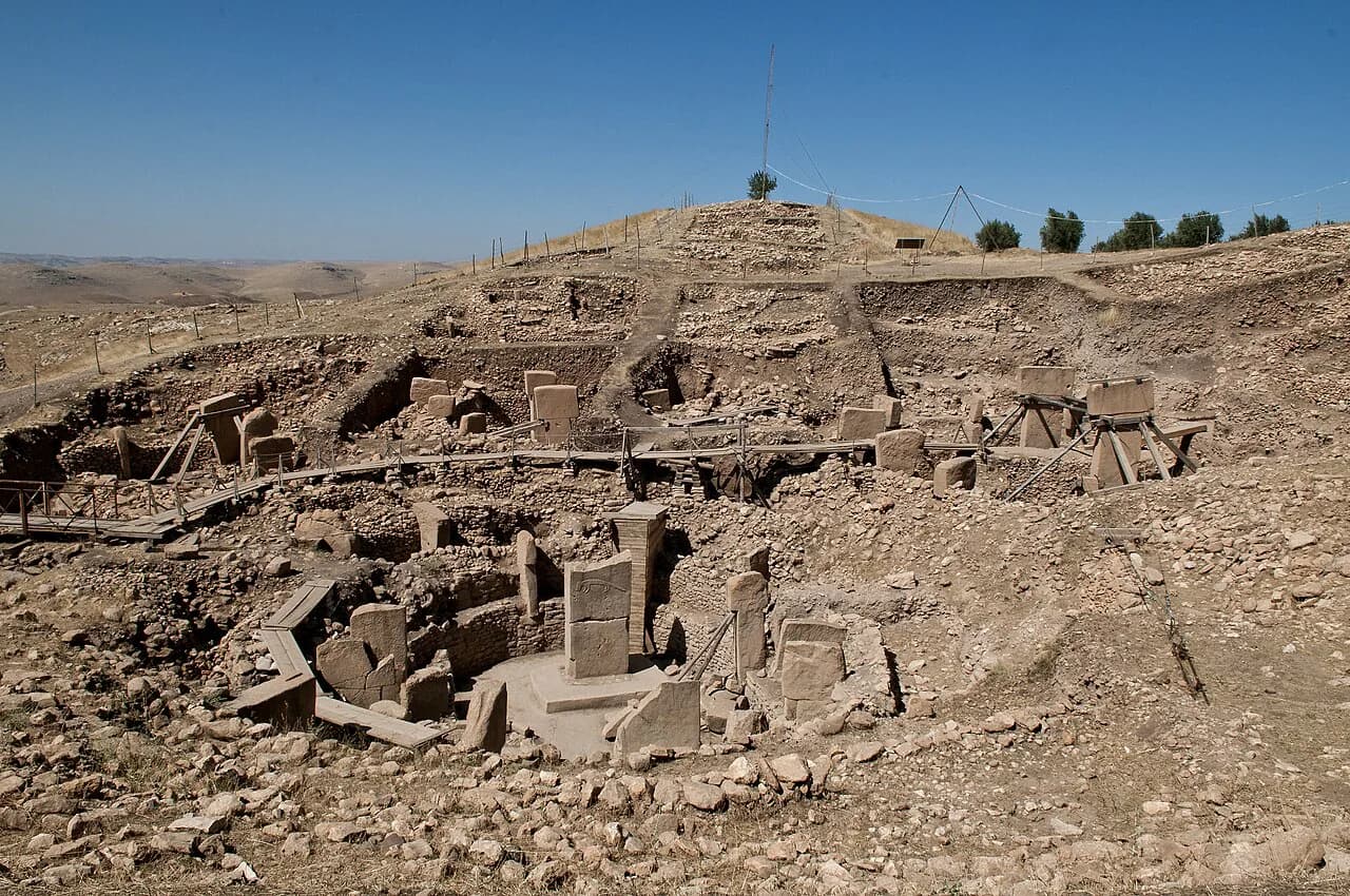
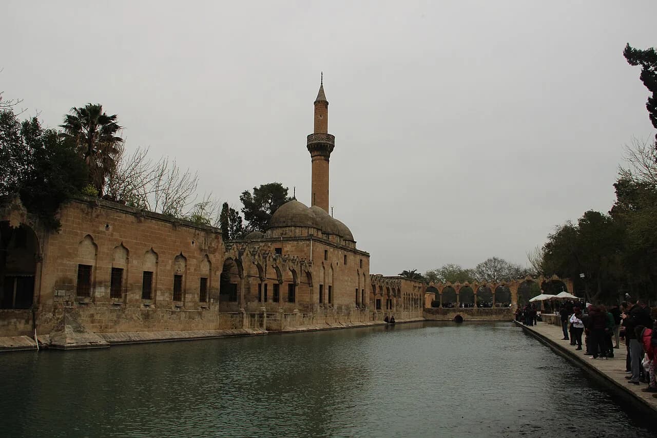
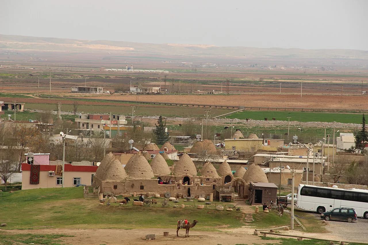
Further south, Şanlıurfa makes a natural next stop, with the Göbekli Tepe on its plain and the balikligol pools in the city centre. If you push on towards the Syrian border, the beehive houses of Harran: Beehive Houses, the Grand Mosque and Getting There from Şanlıurfa make a half-day extension from Şanlıurfa.
Should you build your trip around the summit?
Mount Nemrut earns its place on a south-east Turkey itinerary if you can accept an early start, a rough climb in the dark and a summit with no facilities. Sunset on the West Terrace gives you the same statues with less sleep lost, at the cost of a windier, colder finish.
Build the day around the drive via Kahta, add Arsameia, the Severan Bridge and Karakuş Tumulus on the way down, and keep the next day for Şanlıurfa and Göbekli Tepe. Confirm transport and road conditions with your base in Kahta before you travel.
Explore more Sanliurfa guides
Frequently Asked Questions
Do you need a guide to visit Mount Nemrut?
No guide is required, but you do need your own vehicle or a booked tour, because the summit road is remote. A guide adds context on the inscription and the terraces, which is useful if the archaeology is the reason for your trip.
Can you drive to the top of Mount Nemrut?
You can drive to a car park on the mountain's western flank and walk from there. The final stretch to the terraces is on foot, either by the switchback path on the north side or the older stairway on the south.
What is there to eat or buy at the summit?
Nothing. There are no facilities at the top, so bring your own water and food for the visit and plan to eat back down in Kahta or Karadut. That is one reason the summit works best as a focused half-day rather than a long linger.
Sources
Notes for your next Turkey trip
Optional updates when we add or correct a town guide.
You might also like
Continue reading
More guides you'll find useful